 To
Contents
To Next Page
To Publications
Page
To Home Page
To
Contents
To Next Page
To Publications
Page
To Home Page


U.S. Department of Justice
National Drug Intelligence Center
Rocky Mountain HIDTA Drug Market Analysis 2010
June 2010
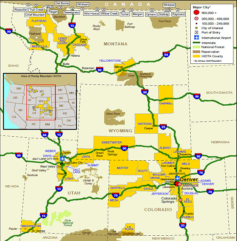
The Rocky Mountain HIDTA encompasses 34 designated counties in Colorado, Montana, Utah, and Wyoming. The region contains large metropolitan areas as well as expansive, sparsely populated areas, including public and tribal lands. (See Figure 1.) The HIDTA region is located between major drug source areas in Mexico and Canada and is linked by extensive interstate highways to major domestic drug markets. The region's highway infrastructure and direct access to drug source areas enable drug traffickers to transport significant quantities of ice methamphetamine, cocaine, marijuana, and heroin into and through the HIDTA region for local consumption and to drug markets throughout the United States. Interstates 15, 25, 70, and 80 are the principal routes used by Mexican traffickers to transport drugs into the region; however, they also use various state and U.S. highways in an attempt to avoid law enforcement interdiction operations. Denver and Colorado Springs, Colorado, and Salt Lake City, Utah, are the three largest metropolitan areas and serve as distribution centers for other regional drug markets, such as Fort Collins, Colorado; Billings, Montana; and Cheyenne, Wyoming, as well as transshipment points for drugs supplied to markets in the Midwest, Southeast, and Mid-Atlantic regions.
Figure
1. Rocky Mountain High Intensity Drug Trafficking Area
d-link
Rural areas of the Rocky Mountain HIDTA region, including 27 national forests and national grasslands, provide traffickers with an opportunity to avoid detection as they engage in illicit activities such as cannabis cultivation. Additionally, drug smuggling from Canada through remote areas in the northern area of the HIDTA region is a particular concern for law enforcement agencies. The 585-mile U.S.-Canada border in Montana has 15 official ports of entry (POEs),a as well as hundreds of easily accessible unofficial crossings.
a. The POEs are based on those listed by U.S. Customs and Border Protection, Office of Border Patrol.
End of page.